Coastal Zone Management Authority and Institute manages a large amount of spatial data and non-spatial information. Under its Data Management Program, the Coastal and Marine Data Centre (CMDC) functions as an integral arm of the institute and other organizations that manage the coastal and marine areas of Belize by providing a framework for the analysis of resource management data.
Data housed in the Coastal and Marine Data Centre aids to monitor trends and assists in influencing critical decisions in respect of the coastal zone, which is done with the aid of Geographic Information System (GIS.)
In 1995, CZMAI became the second government agency to develop and use a GIS, following the development of the Land Information Centre (LIC) as the first government agency with GIS capacity in 1992.
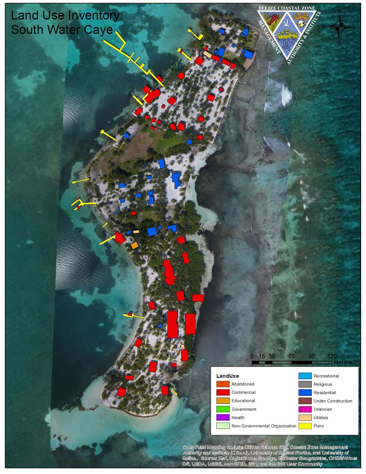
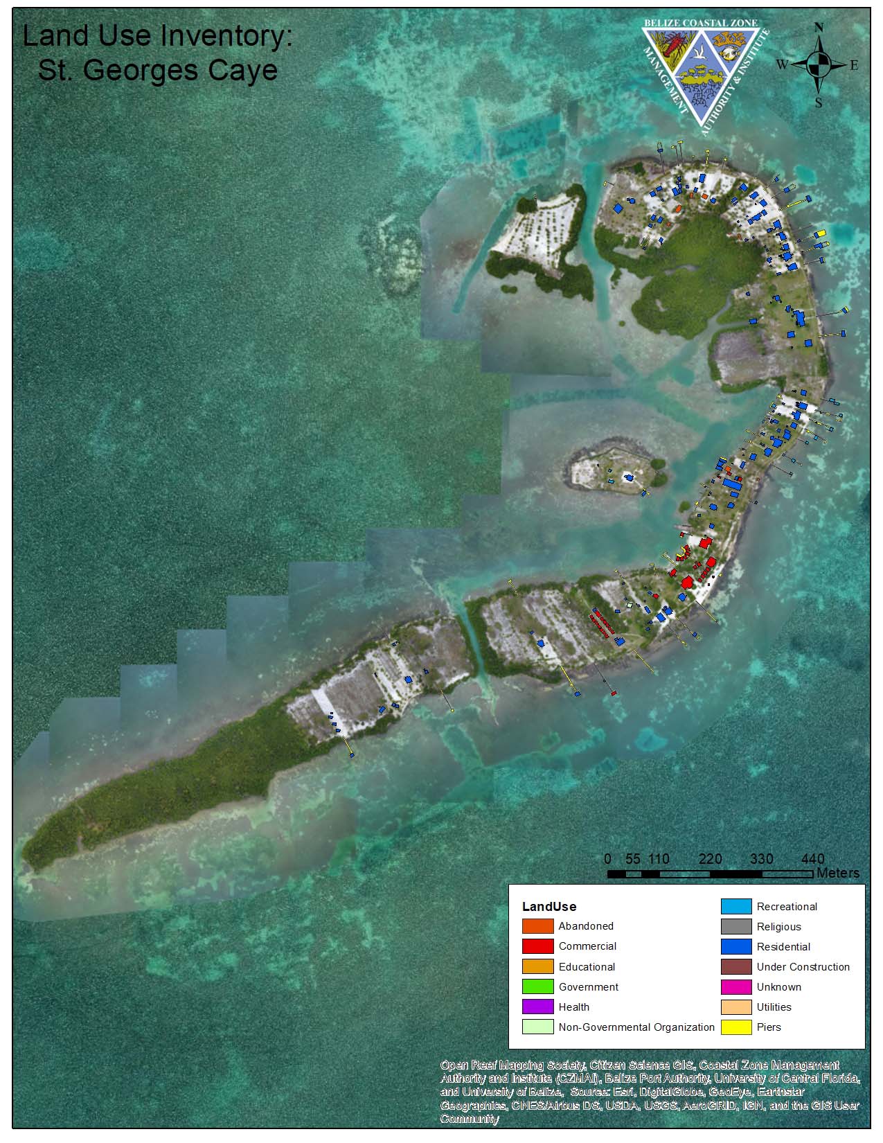
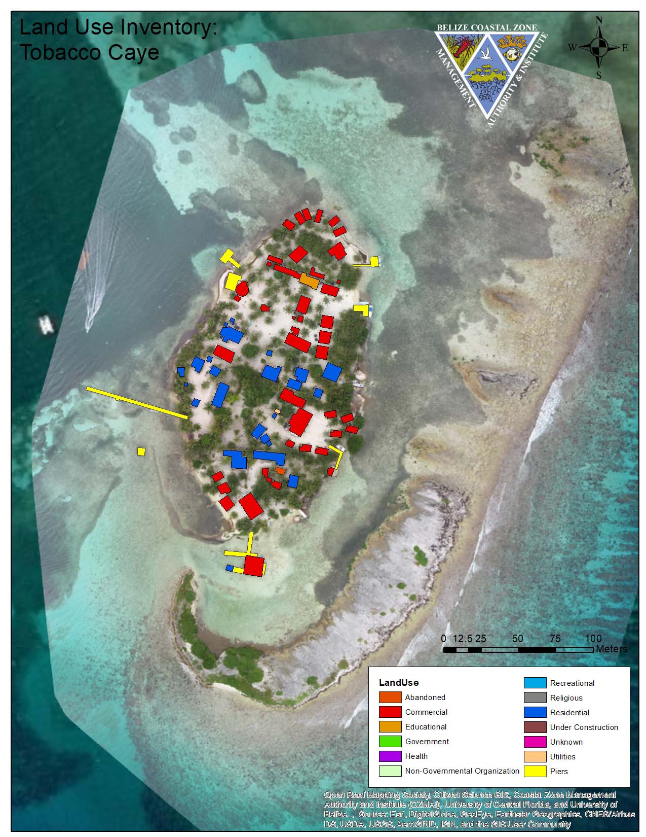
Graphical Information System is an invaluable tool for data visualization, analysis, and a method of making smart maps by attaching data to every entity on them. GIS allows use to effectively capture, store, update, manipulate, analyse and display all forms of geographically referenced information. CZMAI uses GIS to identify areas along the Coast that are fragile and need protection.